Prior to setting out on this trip our experience in Killarney was limited to a single, three night excursion in the summer of 2016. Before we had returend from this first trip we had already begun discussions for the next visit....Andrew began drawing plans for our 10 day loop almost as soon as we arrived home.
This is a popular park with limited backcountry sites, planning in advance is a reccomended . We set reminders in our calanders and booked the entire trip as soon as the 5 month limit was lifted on the Ontario Parks website.

Our route is highlighted on orange and our campsites for each night have been circled.
Night 1&2- Kakakise, Lake #7
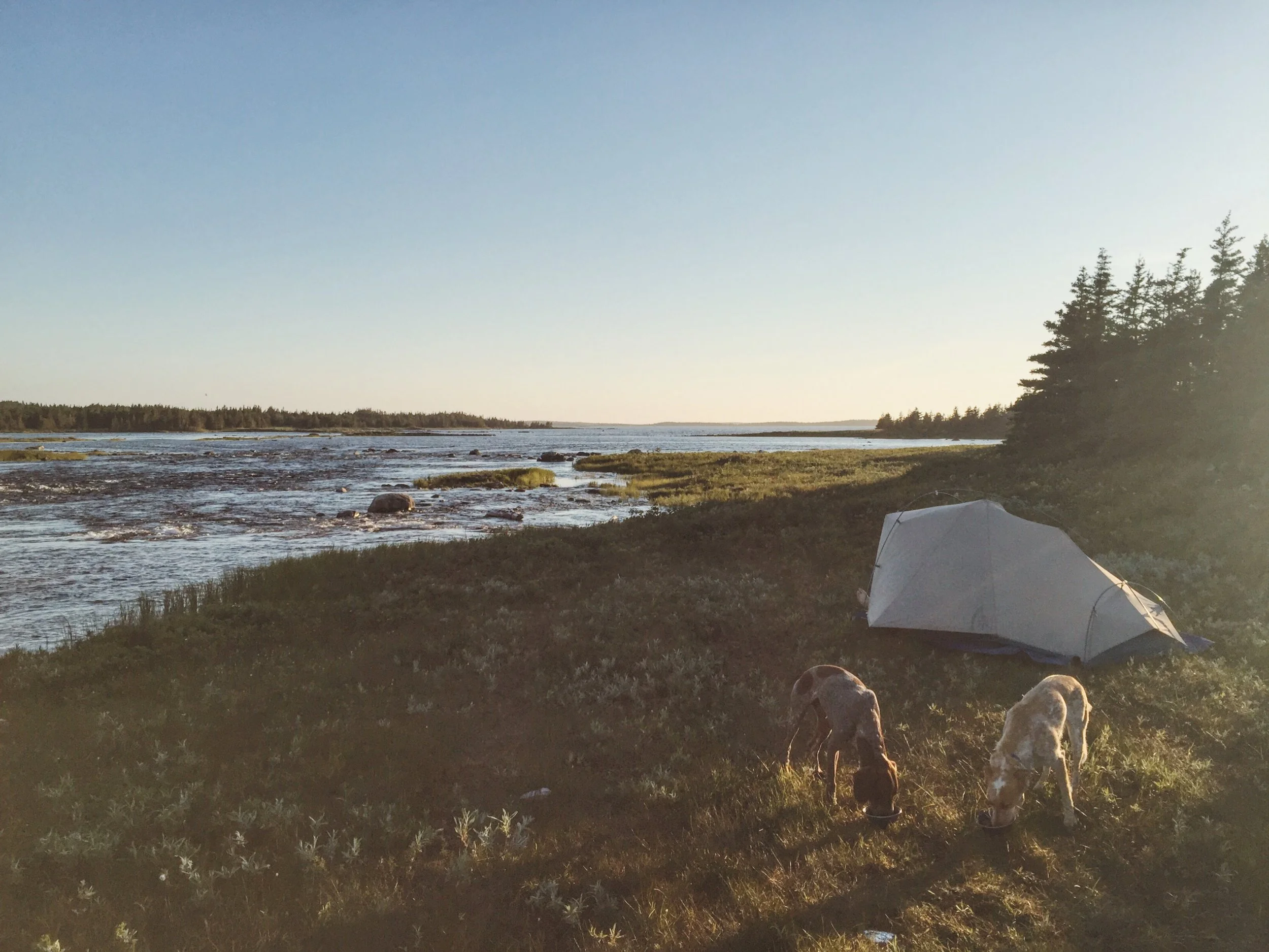
We set out from the George Lake launch with a VERY full canoe. Packs flled to capacity, the dog saddlebags were bursting at the seams with more food than they had ever carted before. Our canoe is a 15 foot cedar strip Prospector. She's a stable and sturdy girl, weighing in at about 70lbs and JUST the right amount of space for 2 adults with full packs and the dogs with all their camping gear. A full and heavy canoe made navigation to the portage between Freeland and Kakakise lake a little difficult. While we were struggling through lower water levels and lush aquatic vegitation we spotted an adolescent black bear on the shore abut 100 feet away from us. Our first and only bear sighting of the trip. Site #7 on Kakakise was spacious and situated on a small penisula which allowed a nice breeze to deter the mosquitos during our stay. There would be plenty of room on this site for multiple tents and it was a short paddle to "the crack" trailhead.

Site # 7 Kakakise Lake (iPhone)

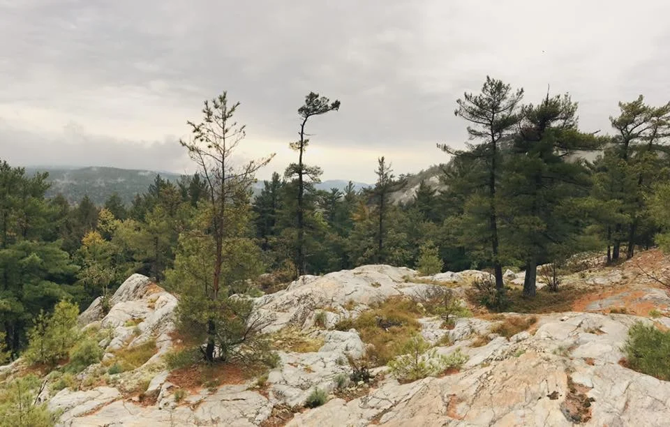
The view from the top of "the crack" hike. (Pentax K1000-Kodak Gold 400)

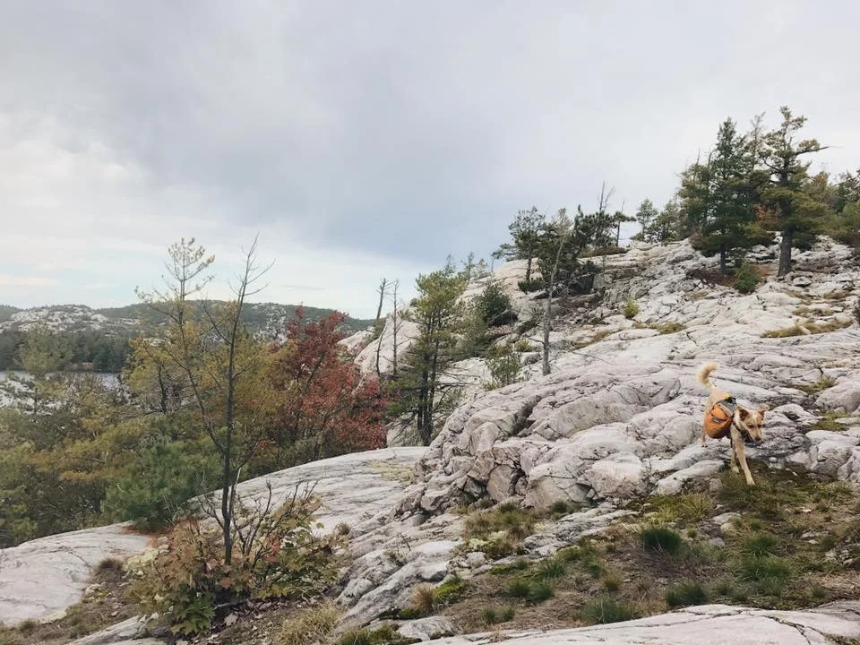
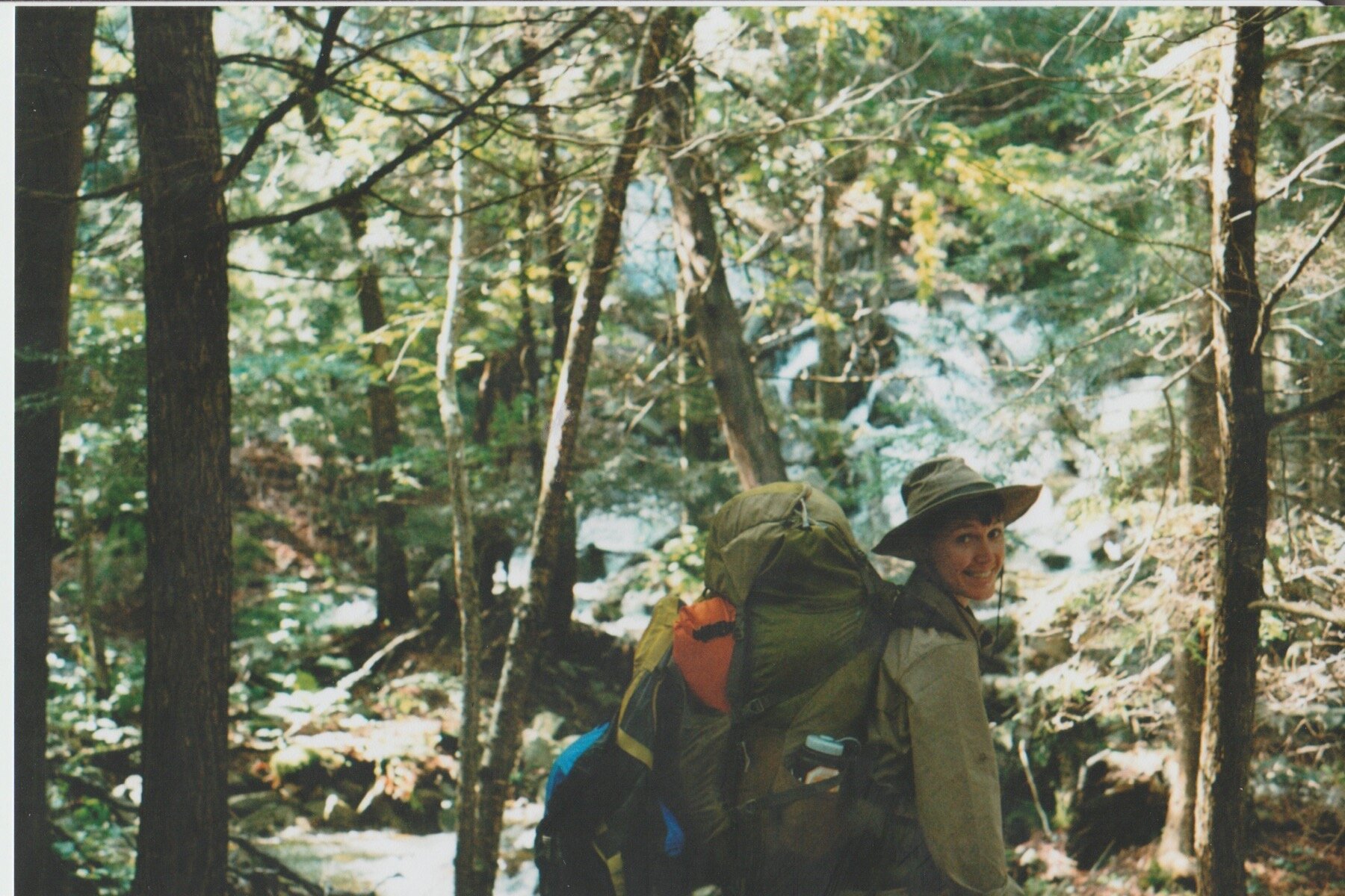
Wendy standing on the iconic white quartzite along Killarney ridge. (Pentax K1000-Kodak Gold 400)

A rather large and surprising friendly snapping turtle. She was keen to help us with our dishes. (iPhone)
Night 3- David Lake, Site #90
We made the paddle through Carlyle and Johnnie Lake fairly quickly after leaving our site on Kakakise. There was a small beaver damn that was a fairly easy lift over however, its always a little trickier with the dogs and a full canoe. A solid ‘sit’ and ‘stay’ command will come in handy if you’re navigating obstacles with your canine friends.

Wendy and Andrew smiling after climbing over the beaver damn in the background. (iPhone)
It was a smooth paddle across the 2 longer lakes. Despite a short burst of heavy rain we managed to keep fairly dry through the subsequent portages that led us through Clearsilver and onto David Lake. The 795m and 935m links between each body of water were well maintained and decently flat. Killarney is definitely not known for short portages, these were each fairly tame and we made good time, even with very full food containers.
David lake is one of the larger in Killarney and has about 15 sites spread into its varied dips. With the day light winding down and rain with a cooler breeze settling in ,it made the search for a campsite feel mildly urgent. We finally came across a site in the north east corner of the lake that was unoccupied and hurried to to set up our tent and tarp. It was a smaller site with nice shallow slanted rock to pull up on. There was a marshy area to the left which was home to a couple loons and several ducks. I wouldn’t put more than one or 2 small tents on this site but it was definitely fine for our quick visit. We went to bed early knowing that our next day would be slightly more challenging physically.
Night 4- Fish Lake, Site # 152
Looking at a map of this park you’ll notice that there’s quite a few portages over the 2000m mark. That, paired with the park’s unique and steep geology can make travel between many of the lakes a bit of an ordeal. The first ‘hike’ of the day was between David and Great Mountain Lake. With 271m of elevation over 2775m, this portage skirts alongside a creek for a good amount of time and pops in and out of the forest while climbing over sections of exposed quartzite. Because of our previous nights rain much of the quartzite rock was fairly slippery. We noticed blueberries growing in abundance throughout certain sections as well.

Despite being very long and reasonably technical, this portage was quite well maintained. This is taken near the end approaching Great Mountain lake.(iPhone)
We stopped to have a quick snack before heading across Great Mountain Lake. Great Mountain is a decently sized remote lake and houses 2 campsites and an impressive cottage on its own large island. We noticed the remains of a cabin as well as we approached the portage to Fish Lake.
Setting out from camp early and planning a trip with reasonable travel times awarded us with a fairly early arrival to the island campsite on the long and narrow fish lake. The site was well used but very picturesque and had fantastic swimming off the smooth, rocky water entry. There were several great tent pad options on this large campsite. We quickly set up and took advantage of the bright sun by rinsing and drying off out a few of our items wile taking a well earned swim.

Wendy and I being pleasant in the sun. (iPhone)

Island site views. (iPhone)

Wendy enjoying the last few hours of daylight. (iPhone)
Night 5- Little Bear Lake , Site #202
We set out early for a slightly longer day of paddling, reservations on Little Bear Lake meant dealing with a handful of steep portages along the way in this rugged and isolated areas of the park.
Howry has the potential to be a difficult navigation depending on water levels. We were in luck as it seemed to be quite navigable and arguably one of the highlights of the whole trip. We slowly made our way through a grassy paradise and were able to enjoy the current gently guiding us through the maze of green. The creek flows into Howry Lake and we were able to ride the steady current right over a beaver damn and into the opening of this larger body of water.

Ready to push off Fish Lake island in the AM. The dogs are always eager to jump into the canoe……sometimes a little too eager. (iPhone)

Howry creek with a healthy water level provided us with easy passage. One of the most beautiful places we’ve ever paddled. (iPhone)
We had 3 portages between Howry and Little Bear Lake to tackle this day, 2 of 3 were very muddy and lined with a very noticeable amount of poison ivy. We spent some time rinsing the dogs off in Cat lake as they were both covered in mud and potential itchy contaminants. The 240m portage between Rocky Lake and Bear Lake is on the shorter side of things but features 236m of elevation over its course, thankfully it was not as mucky as the previous two trails.
When we arrived at the Rocky Channel the wind had picked up significantly and storm clouds were becoming a noticeable presence on the horizon. We battled a headwind heading West towards our destination on Little Bear Lake. After roughly an hour of difficult paddling we arrived in the south western pocket of the lake in which there are 2 campsites, site #203 was the first one we crossed. After hopping out of the canoe to take a closer look we were disappointed to see it quite overgrown and littered with a significant amount of broken glass. We made the quick decision to head to site #202 which was only a few hundred metres west, it proved to be far more inviting despite being along a fairly busy cottager route. We were able to make small talk with a few groups of people passing by the site in motorboats.
We set up camp just in time to ride out the brief but dramatic thunderstorm we had been trying to outrun all afternoon. Poor Wendy hates thunderstorms and we lovingly referred to her as ‘Weatherdog’ during this trip, her peaked anxiety would always indicate some thunder would be gracing us in the near future. The storm cleared hours before dark and left us with a lovely sunset. We watched a muskrat swim back and forth between some tiny islands as the sun disappeared behind the trees one more time.

All set up and ready to ride out the storm. (Pentax K1000-Kodak Gold 400)
Night #6- Nellie Lake ,Site #144
We set out a little earlier this day to get a decent head start and allow for a longer stay at our much anticipated destination on Nellie Lake. We began travelling through another couple rather muddy portages, a coniferous lined 365m between Plunge and Leech Lake and a long and gradually inclined 1055m between Leech and Murray Lake.

Early mornings looking towards Little Bear Lake, Site #202 (iPhone)
The short ride across Murray Lake put us at the foot of ‘The Notch” which is one of the most notorious portages in the park. It climbs (almost vertically in some sections) almost 300m over a lengthy 1420m. The toils of this route are heartily rewarded as it is flanked by several waterfalls along its course. There are several places to rest with spectacular views of water rushing over white rock in the middle of the forest.
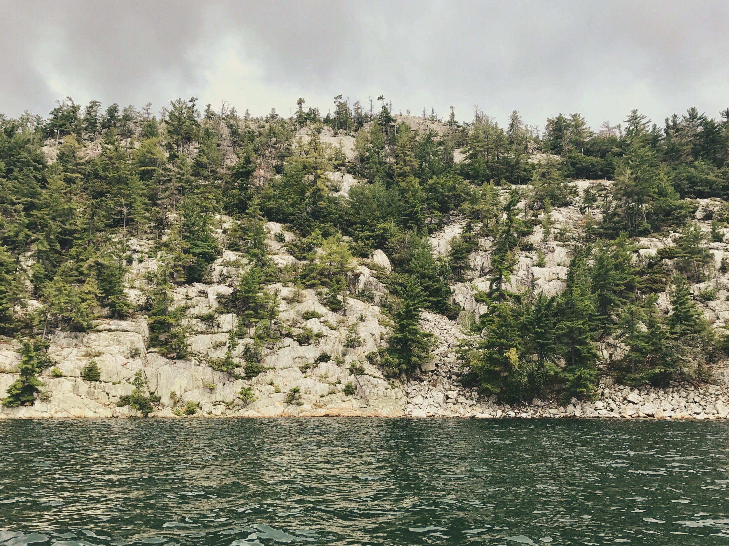
Nellie is one of the most difficult to reserve Lakes in the park. Spanning roughly 6km end to end it has only 3 campsites which are all located on the western edge. Its crystal clear water and stunning framework of white cliffs make it one of the true jewels of the park. On a calm day you can see 28 metres down, a combination of historical acid rain and a larger than average amount of calcium carbonate in the water prevent most vegetation from growing in the lake, which give it an eerily stunning appearance.

A friend at the portage head on Leech Lake. (iPhone)

The steepest portion of ‘The Notch’ , thanks Andrew! (iPhone)

Waterfall at the base of ‘The Notch’ (Pentax K1000-Kodak Gold 400)

Halfway up! Wendy takes a little breather along the creek. (Pentax K1000-Kodak Gold 400)
Loaded up, no double carries!! (Pentax K1000-Kodak Gold 400)
We arrived at site #144 after passing a group of ladies on our way in on site #142 and chatting about their cedar canoe that was almost an identical twin to Seadoggie! The site was stunningly beautiful with easy swimming off the shallow rocky beach (Nellie is cold!) and lots of flat ground for easy tenting. There was no shortage of firewood and the site was home to some very large/old pines. We spent the afternoon bathing in the clear water and attempting to identify some of the dozens of mushrooms that were growing in abundance. We had only been able to book one night on this lake, had we the option we 100% would have stayed for a few days to explore the remote area. I cant wait to return one day.

Nellie as seen from campsite #142. (iPhone)

An evening paddle around the Lake (iPhone)

Rufio (iPhone)
Night 7- East Channel, Site # 135
All journeys in and out of Nellie Lake are long ones. We took the 2425m portage towards Helen Lake, it was mostly downhill which was a welcome change, but it still provided us with a few technical challenges along the way which only exasperated its length . That being said, we were still happy to be loosing elevation for once.
Helen and Low Lake are truly beautiful and would be fantastic to revisit. The 60m portage between the two was exposed and rocky, It was a pleasant change from the almost 2.5 km we had just spent spent in the muddy woods.

The beautiful portage between Helen and Low Lake. (iPhone)
Between Low Lake and the east channel our route winded through narrow, rocky waterways and sections of heavy aquatic vegetation. The constant changes in scenery and ecosystems was quite dynamic and made finding the final 55m portage slightly difficult amongst the sea of lily pads and bullrushes.

(Pentax K1000-Kodak Gold 400)
We were lucky to find a campsite on the East Channel that was a little further along our route and would make for a shorter trip to our next checkpoint in the morning. We had read that the conditions of the campsites along this stretch of the park were in poor condition so we were very happy to find that this one wasn’t bad at all. Although it was quite small and had a limited area for tent placement, it DID have a picnic table (very luxurious). What it lacked in tent space it made up for in views and easy water access.
Marshy scenery between Low Lake and The East Channel. (iPhone)

Site #135 (iPhone)

Seadoggie and our paddles ((Pentax K1000-Kodak Gold 400)
Night 8-Baie Fine Site #37
We Departed from site #135 into steady rainfall and winding channels that led us out to the great expanse of McGregor Bay. This would be our second time visiting Baie Fine but our first time approaching it from the north. We decided to take the unofficial but very well maintained 940m portage that links the two inlets. When padding with 2 dogs its sometimes a little easier to take a route with a couple extra portages so they can have a chance to stretch their legs. It also allows us to explore areas of the park we may have simply paddled through and never been able to enjoy.

McGregor Bay (iphone)
Baie Fine )iPhone)
The long paddle into the sheltered area of Baie Fine was windy and a lot more exposed than we had been used to for the majority of this trip. It was not without charm, being lined with the iconic white cliffs for its entirety we were happy to enjoy the landscape as we paddled hard towards our site.
The view from site #37 was just as we had remembered and it felt good to be in an area of the park we had already become familiar with. The site across from ours (#38) was unavailable due to a large tree that was dangerously close to falling over. Baie Fine is a perfect place to spend a few nights as it allows easy access to some of Killarney’s most beautiful day tripping destinations. Topaz and Artist Lake are both a short paddle and portage away and there is excellent swimming off the site.
With our trip nearing its end we were feeling elated to know our next destination (O.S.A.) would be equally as beautiful and possibly have the added bonus of additional company for the first time in over a week!

Baie Fine (Pentax K1000-Kodak Gold 400)
Night 9, O.S.A Lake Site#30
We made short work of the travel between Baie Fin and O.S.A. Lake. We had paddled through this entire section the previous year and its easy to see why this is such a popular section of the Park. O.S.A. is supremely clear and shallow, providing a sparkling turquoise contrast to some of the most breathtaking mountain backdrops in the park. We were lucky to find site #30 empty as it is extremely spacious, sheltered, and has a million dollar view of the mountains on the opposite side of the lake.

O.S.A. Lake (Pentax K1000-Kodak Gold 400)

Beer Friends! (Pentax K1000-Kodak Gold 400)
We had organized to meet a couple friends for our final evening in the park. With no cell service and over a week since the plans had been solidified it was super exciting to see James and Brendan pull up with a canoe full of beer. It was great to have some extra company and the site easily accommodated the extra tent and hammock.
O.S.A. is relatively easy to access from the George Lake launch point, that paired with its phenomenal views make it extremely difficult to book, its worth the extra effort to convince a few friends to come along and enjoy the scenery if you’re lucky enough to book a spot, especially in the summer months.
This was the ideal way to spend the last night of our trip, friends and one of Ontario’s most beautiful bodies of water. We’re beyond lucky to have seen so much of the park and couldn’t have asked for better luck with weather, and good behaviour from our dogs.
Its been over 2 years since we arrived home from this trip and I’ve since returned several times….the memories sparked from each of these photos while writing have been clear and vivid, this place is unlike anywhere else and its such a gift to be able to recount its unique splendor. It will keep me returning for years to come.

Rufio posing with Brendan’s tent. (iPhone)

Looking west off site #30 (iPhone)

Wendy and the wall (Pentax K1000-Kodak Gold 400)